

| Total Islands | 9 |
| Autonomous Region Capital | Ponta Delgada (São Miguel island) |
| Distance from Lisbon | Approximately 1,400 km west |
| Highest Point | Mount Pico, 2,351 m |
| UNESCO Sites | 2 (Angra do Heroísmo city; Pico Island vineyard landscape) |
| Official Currency | Euro (EUR) |
| Time Zone | Azores Standard Time (UTC−1; UTC+0 in summer) |
| Total Land Area | Approximately 2,330 km² |
What the Azores Actually Are
Float a finger across a globe from Lisbon heading west, and after roughly 1,400 kilometers of open Atlantic you'll land on the Azores — nine volcanic islands scattered across nearly 600 kilometers of ocean. Administratively, they form an autonomous region of Portugal, meaning they have their own regional government and parliament while remaining part of the Portuguese Republic and the European Union. That distinction matters practically: EU citizens travel without passport checks, and the euro is the currency, but governance, culture, and even time zone (one hour behind mainland Portugal) carry a distinct island identity.
The archipelago is divided into three geographic groups. The Eastern Group — São Miguel and Santa Maria — sits closest to mainland Europe. The Central Group includes Terceira, Graciosa, São Jorge, Pico, and Faial, and is where much of the islands' cultural heritage concentrates. The Western Group, Flores and Corvo, is the most remote and least visited. Together, the nine islands cover about 2,330 square kilometers of land.
| Total Islands | 9 |
| Autonomous Region Capital | Ponta Delgada (São Miguel island) |
| Distance from Lisbon | Approximately 1,400 km west |
| Highest Point | Mount Pico, 2,351 m |
| UNESCO Sites | 2 (Angra do Heroísmo city; Pico Island vineyard landscape) |
| Official Currency | Euro (EUR) |
| Time Zone | Azores Standard Time (UTC−1; UTC+0 in summer) |
| Total Land Area | Approximately 2,330 km² |
For a broader sense of how Portugal's regions diverge in character and landscape, comparing mainland Portugal's coastal and interior regions offers useful context.
Island by Island: Key Differences
No two islands in the Azores are interchangeable, which is part of what makes the archipelago interesting as a reference subject.
- São Miguel is the largest island and home to the regional capital, Ponta Delgada. It contains the twin crater lakes of Sete Cidades, geothermal hot springs at Furnas, and the bulk of the region's tourism infrastructure.
- Pico hosts Portugal's highest point, Mount Pico, a dormant stratovolcano reaching 2,351 meters. Its UNESCO-listed vineyard landscape — stone-walled plots called currais — is among the most distinctive agricultural scenes in Europe.
- Terceira centers on Angra do Heroísmo, a UNESCO World Heritage city and the oldest European settlement in the Atlantic islands. Its baroque churches and fortifications reflect centuries of trans-Atlantic trade history.
- Faial, nicknamed the Blue Island for its hydrangea-lined roads, contains one of the Atlantic's most important sailing marinas — a historic waypoint for transatlantic crossings.
- Flores is widely considered the most scenically lush of the nine, with waterfalls, calderas, and endemic flora, but its remoteness means ferry and flight connections are limited and weather windows matter.
Autonomous Region
A territory within a sovereign state that holds its own elected government and legislative powers over certain matters, while remaining subject to the national constitution. The Azores and Madeira are both autonomous regions of Portugal.
Stratovolcano
A tall, steep-sided volcano built up from alternating layers of lava, ash, and rock fragments. Mount Pico on Pico Island is a classic example and the highest point in Portugal.
Caldeira / Caldera
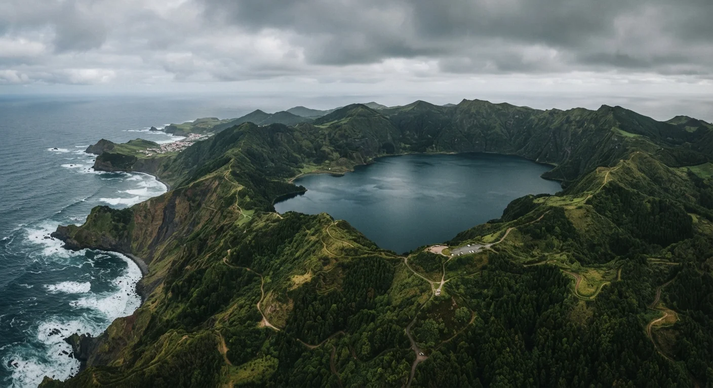
A large depression formed when a volcano's magma chamber empties and the land above collapses inward. Several Azorean islands feature caldera lakes, including the famous Sete Cidades on São Miguel.
Currais
The traditional stone-walled enclosures used to protect grapevines from Atlantic wind and salt spray on Pico Island. The vineyard landscape they create is recognized as a UNESCO World Heritage Site.
Temperate Oceanic Climate
A climate type characterized by mild temperatures year-round, relatively high humidity, and frequent cloud cover or rainfall driven by prevailing ocean winds. The Azores exemplify this classification within the Atlantic.
Climate, Seasons, and What to Expect
The Azores sit in the path of the North Atlantic weather system, and visitors are wise to understand what that means before building expectations. The islands have a temperate oceanic climate — mild year-round but famously changeable. Locals have a saying that you can experience all four seasons in a single day, and it is not much of an exaggeration. Annual rainfall is significant, and low cloud is common even in summer.
That said, patterns are meaningful. July through September generally offers the most stable, warmest conditions, with average temperatures in the low-to-mid 20s Celsius on São Miguel. Spring brings vivid greenery and hydrangea blooms across multiple islands. Winter is mild by European standards — rarely below 12°C even at sea level — but persistent rain and rough seas can limit inter-island ferry travel and some outdoor activities.
Entry and Travel Requirements Vary
Because the Azores are part of the EU, Schengen-area travel rules apply for most European citizens. Travelers from outside the Schengen zone — including the United States — should verify current visa and entry requirements with official Portuguese government or embassy sources before booking. Conditions can change, and no third-party source should be treated as definitive for entry rules.
Visitors arriving from mainland Portugal should adjust expectations: the Azores' natural environment is fundamentally shaped by volcanic geology and Atlantic exposure, making it a genuinely different experience from both the Algarve coast and the Alentejo plains.